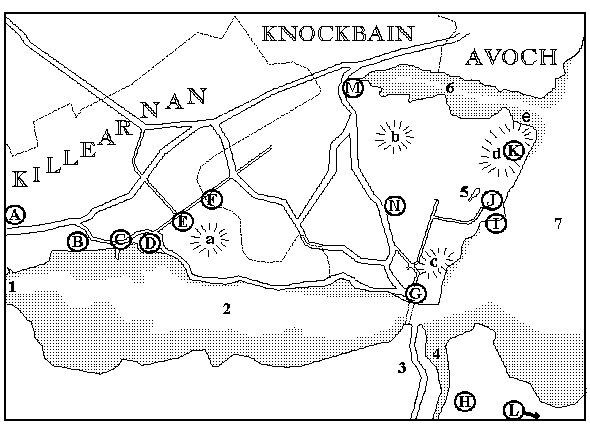
MAP KEY |
|||
|---|---|---|---|
WATER |
1 River Beauly 4 River Ness 7 Inner Moray Firth |
2 Beauly Firth 5 Loch Lundy |
3 Caledonian Canal 6 Munlochy Bay |
LAND FORMS |
a Gallow Hill d Craigie Howe |
b Drumderfit Hill e Cave of the Feinns |
c Ord Hill |
TOWNS, |
A Quarry D Redcastle G North Kessock J Shore-of-Drynie M Munlochy |
B Spital Shore E Chapletown H Inverness K Taindore N Drumsmittal |
C Killearnan Church F Parktown I Kilmuir L Culloden |